Established in Hong Kong 1996


Company activities

Cosine Ltd is an independent geophysical consultant, engaged on detection and assessment of geotechnically difficult ground conditions and subsurface obstruction delineation. We design geophysical measurement programmes for investigation of subsurface irregularities, expressing the results in terms of  probabilities that can be tested and mitigated through directed ground investigation (GI) or accommodated in the engineering design.  Cosine does not normally  undertake the survey measurements directly but typically we function as an interface between the geophysical survey operator and the client end-user, usually consulting engineers and government departments.  We do provide QC and QA monitoring to optimise data quality and efficiency.

Core services
Portfolio

Examples of Cosine input to major infrastructure development projects in Hong Kong, Kuala Lumpur, Singapore, Philippines and elsewhere overseas  :

        Marine magnetic data processing to define geological structural faults for offshore tunnelling alignments.  Hong Kong
        Site investigations for public housing schemes and major construction developments to determine and benchmark geotechnically irregular rockhead conditions, Hong Kong
        Investigations of karstic environments for void and fissure detection and delineation, in urban and rural environments,Hong Kong, Kuala Lumpur and Philippines
        Development of soil nail integrity testing methods. Hong Kong
        Delineation of piles from inclined boreholes, evaluation of alignments between them and the potential for impedance to proposed pipes. Hong Kong
        Determination of rockhead surfaces in environmentally and time restricted access conditions. Singapore

Contact :   enquiry@cosine-ltd.com           P.O. Box 33222.  Sheung Wan. Hong Kong               Aug 2020                            Return to   home


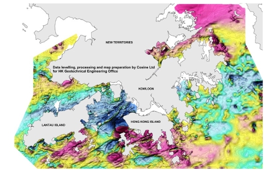
The marine magnetic map of Hong Kong
Magnetic survey data blending, levelling, magnetic suppression of anchored ships, container docks, cranes, wrecks etc., and map creation by Cosine Ltd


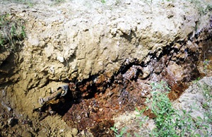
3-D model of karstic limestone surface by interpretation of gravity data.  Depth approx. 100m below surface. 
Yuen Long. NT
.Hong Kong


GPR image and the exposed
contaminated waste pit. 


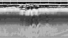
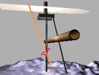
Concept of vector magnetic profiling in inclined borehole for pile delineation

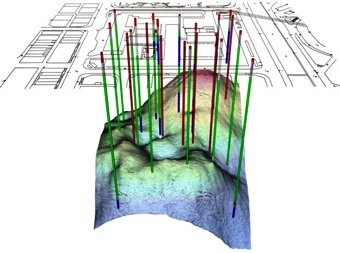
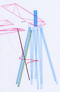
3-D model based on 'as built' pile data for directing the geophysical drillhole through utilities and pile clusters


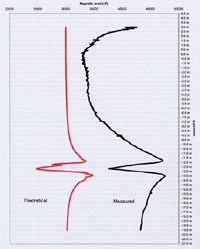
Example of computed and measured profile to determine actual pile offset and locus through 3-D model


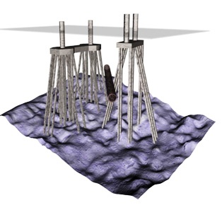
The final model and the proposed tunnel alignment for which minimum safety clearances could be calculated against the computed locus of the theoretical pile